↓
 

  • Home
  • About Me
  • Books
  • Media
  • Contact & Mailing List
  • Blog
Home→Published 2016

Yearly Archives: 2016

Exploring the Dungeness Refuge

December 10, 2016

By Dorothy Rice Bennett

If you are heading west out of Sequim on the 101, you’ll find a brown sign just before the exit to Kitchen-Dick Road that says “Dungeness National Wildlife Refuge.” Be sure follow the arrow on that sign. It’s well worth a few miles drive off the highway.

A long time ago, the Sequim-Dungeness Prairie was wilderness, a desert kind of wilderness, but wilderness nevertheless. Residents were the members of  Jamestown S’Klallam tribe of Native Americans. Then settlers moved in near the end of the nineteenth century and with irrigation the prairie became farming country, with at one time approximately one hundred dairies in operation. Today there are two dairies, some ranches and farms, lots of houses, a few businesses, and the city of Sequim. But the wildlife of the area still has a protected home within the Dungeness Refuge.

Unlike the national parks, the Dungeness Refuge is part of the National Wildlife Refuge System and is administered by the U.S. Fish and Wildlife Service. The system comprises a network of lands and waters set aside for the conservation of America’s fish, wildlife, and plants.

Upper and lower levels

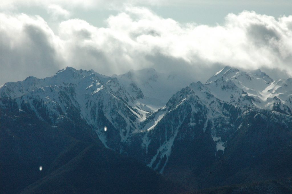
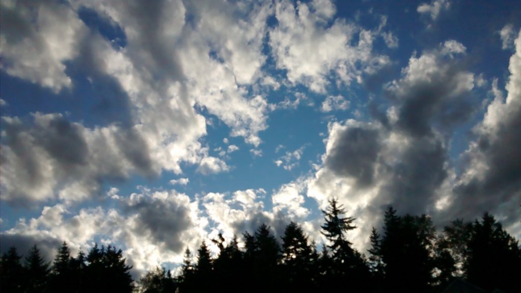
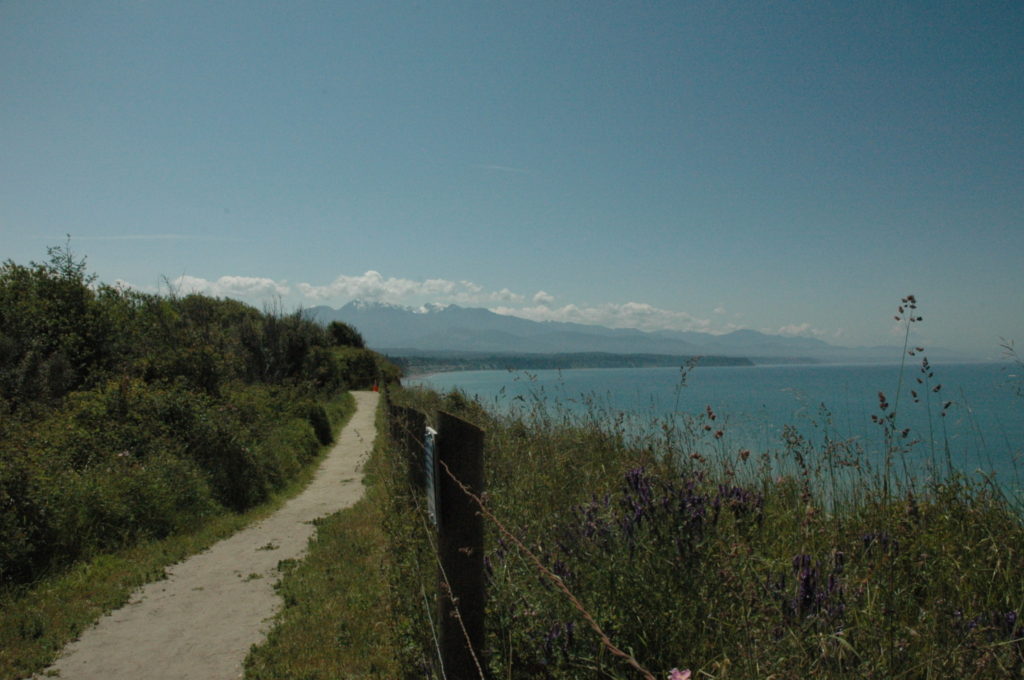
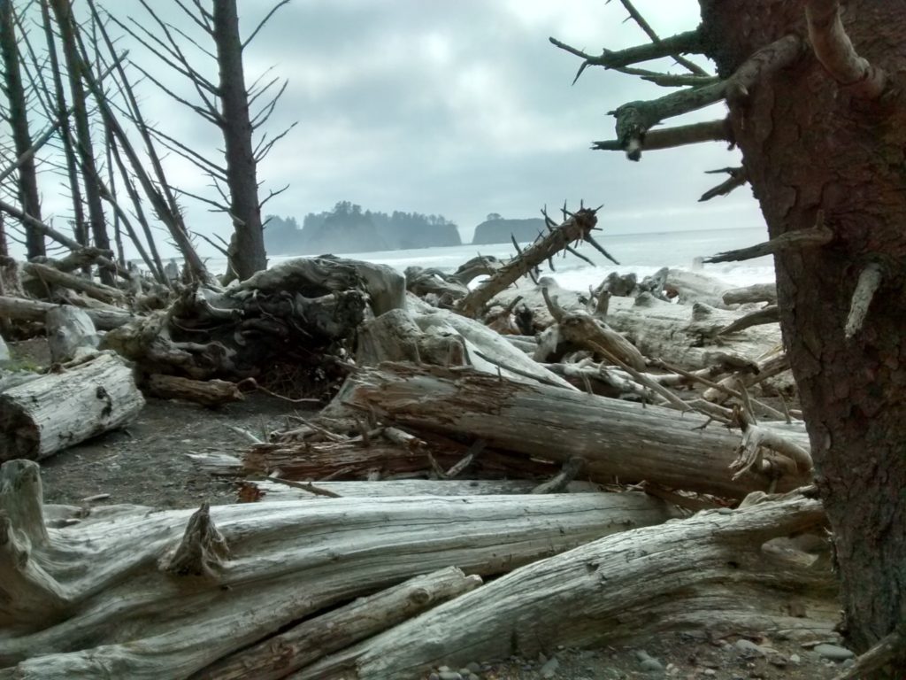
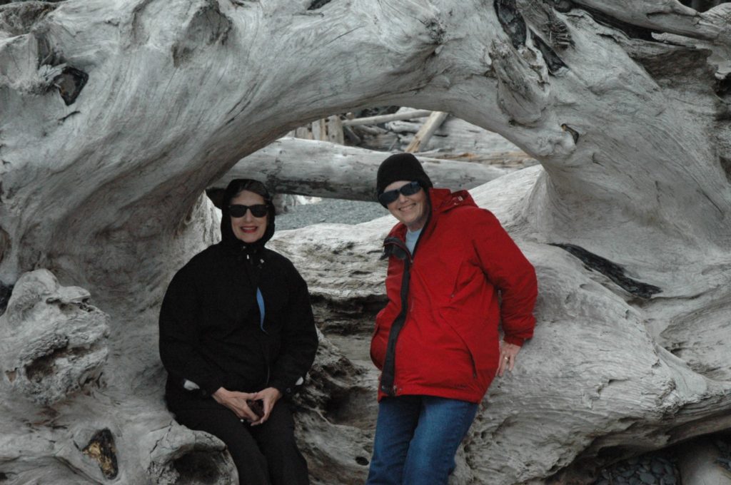
The Dungeness is divided into two main areas. The first is a land mass mostly covered in both evergreen and deciduous trees on a bluff overlooking the Straits of Judsc_3505
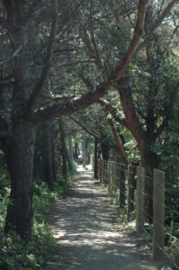
an de Fuca. On that land mass there are roads, trails, parking areas, and spots for camping and picnicking. Most of this upper area is open to dogs on leashes. It includes a lengthy trail overlooking the Washington coastline with views to the west to Port Angeles, the Olympic mountains in the background, and Vancouver Island and Victoria, B.C., to the north.

The second area is mostly at sea level and includes a beach below the bluff and a spit, one of the longest in the world, that leads eastward to the New Dungeness Lighthouse, some five and one half miles away. This second area has a formal entrance and is manned by Dungeness Refuge volunteers. There is a small fee to enter the area. The path down to the spit is also restricted in that no dogs are allowed.

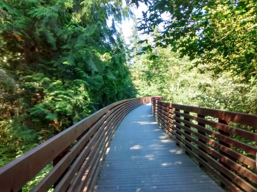
The trail down to sea level and the spit passes through forest terrain, some of it fairly rugged, but with a clear and wide path that is paved most of the way. Going down is easier; coming back up can be a challenge for older adults (like me) with any physical limitations.

Located about twenty minutes from d
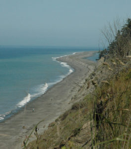
owntown Sequim, the Dungeness (as it is locally called) is an amazing community asset. Open year round in the daytime, it is a great place for a dog walk or a picnic, and there are enough things to do to fill an entire afternoon, when you bring along binoculars and/or a camera.  Maybe a walking stick.

On the upper area, there is parking available very close to the picnic tables overlooking the bluff. There are pullouts with parking, so visitors can take a look at the beautiful Straits with waves crashing on the shore below. The camping sites are mostly located within the trees, for peace, quiet, and privacy. Bring the tent or the RV and have a good weekend vacation. In the main parking lot, located just before the entrance to the trail down to the spit, there are clean and modern public restrooms.
More than 100 years old

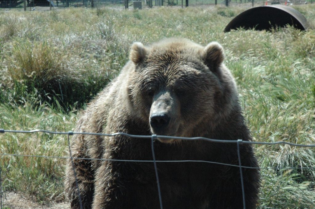
The Dungeness was established by President Woodrow Wilson on January 20, 1915, to provide a refuge, a preserve, and a breeding ground for native birds. The lengthy Dungeness Spit today still continues to protect migrating shorebirds. It provides calm waters for wintering waterfowl—it also supports harbor seals and their pups and provides abundant beds for young salmon and steelhead fish.

Some areas of the refuge are restricted and certain sporting activities are not allowed, if they would disturb the wildlife in residence. The volunteer staff can provide information on what is permitted and where, or you can check on the Internet before visiting the park.

Getting to the Dungeness is easy. After turning off the 101 at Kitchen-Dick Road, just drive north through the prairie to the end of the road; turn right on to Lotzgesell Road, go a very short distance, and then turn left into the Dungeness. A single main entrance takes you through grassy lands, with tall trees to your left and ahead. Keep driving to the end of the road to reach the main parking lot. (The official address is 554 Voice of America Road West, Sequim, WA 98382) If desired, stop at any pull out along the way to get a look at the Straits. There is no admission fee. Hours are posted at the entrance and vary seasonally.

For further information on the Dungeness National Wildlife Refuge, go to https://www.fws.gov/refuge/Dungeness/

Have fun at the Dungeness, which is incredibly beautiful. It is one of my favorite outdoor places and one of the “secrets” of Sequim that make this community such a wonderful place in which to live.

December 10, 2016 by dorothy Posted in blog Reply

Giving Grateful Thanks at the Lodge

November 23, 2016

By Dorothy Rice Bennett

A long-time friend called and suggested, “Let’s go out to Lake Crescent Lodge for Thanksgiving dinner.”

Wow! What a perfect idea! Only an hour to the west of Sequim—about eighteen miles beyond Port Angeles—Lake Crescent forms part of the northern Olympic National Park boundary. The lodge is located on the southern shore, just a few blocks off Highway 101, but nestled deep in the forest as the main highway passes along the scenic border of this incredibly deep and beautifully blue lake.

Lovely and rustic, the lodge and its cabins have known many years of use and are enjoyed by locals for daytrips, overnights, and longer stays. But, since the Olympic Peninsula is on the remote northwest tip of the Continental United States, the lodge is still a fairly quiet place, and the lake itself is pristine—not yet the tourist attraction that Hurricane Ridge has become.

Long history

When I wish for physical beauty, peace and quiet, I go to Lake Crescent. Formed by glaciers—and separated from near by Lake Sutherland by a landslide nearly 7,000 years ago—the lake is approximately 600 feet deep and very blue—caused by a lack of nitrogen that inhibits algae growth—and inhabited today by variants of trout fish. On beautiful summer 
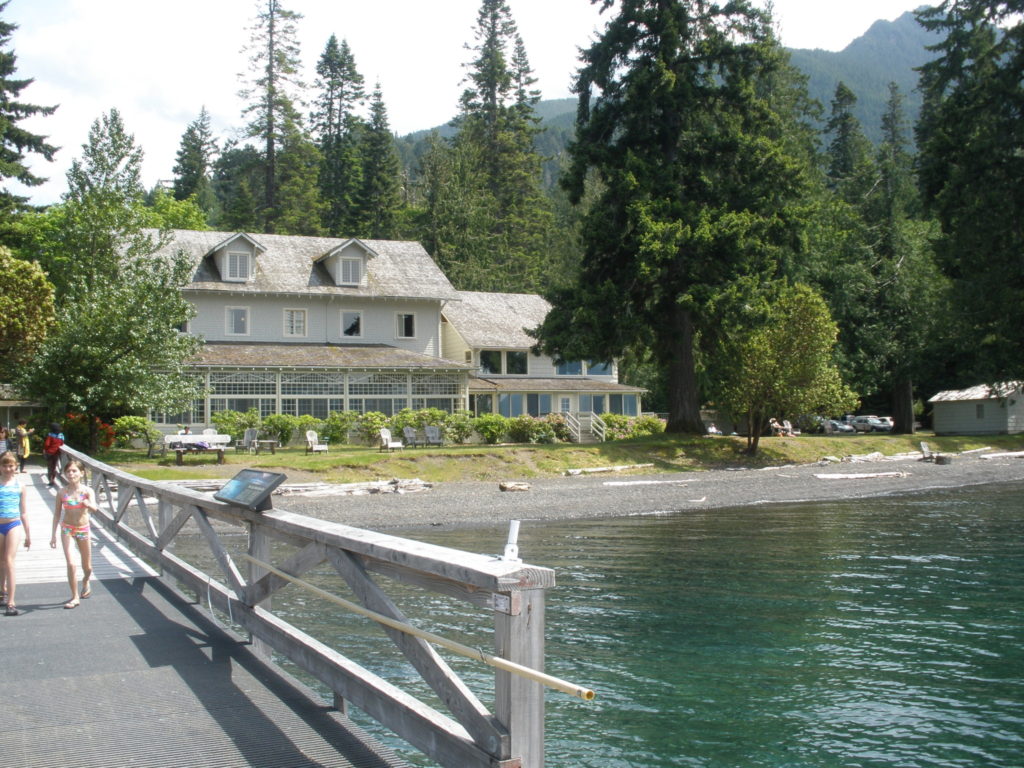
days, Lake Crescent remains amazingly quiet. Kayaks, canoes, and sailboats can be seen out on the water, and at some places an occasional small motorboat appears moving along. But stillness reigns.

Lake Crescent Lodge actually has a longer history than the national park itself, having been built as a tavern with lodging rooms in 1914. When President Franklin D. Roosevelt visited the Olympic Peninsula in 1937 with the view of making the mountainous region into a national park, he stayed at the lodge. After ONP was officially founded in 1938, the original privately-owned lodge was gradually folded into the park structure. Some early buildings were torn down but the old lodge still stands.

This main building features a lobby with fireplace, dining room, gift shop, rest rooms, bar, reservations center for tours and boat rentals, a long enclosed porch, and rooms above—reachable by a staircase. The season until a few years ago ran only during the summer months but has gradually been extended into the fall and until the holidays, closing after New Year’s and reopening in late April. Numerous cabins, rooms, and condos—some older and rustic, some newer and fancier—dot the area around the main building. Some are open seasonally, but the Roosevelt Cabins are open on weekends even during the winter.

Outdoors by the lake, tables, fire pits, benches and chairs all offer a quiet place to contemplate and take pictures under huge evergreen, madrone, and deciduous trees. Nearby are several forest trails.

Whenever company visits our home in Sequim, it is always my goal to include a luncheon trip to Lake Crescent Lodge. Along with ONP’s famous Hurricane Ridge a mile high into the mountains, Lake Crescent is an incredibly beautiful feature of the park—and easily accessible from the 101. Whether eating formally in the dining room, or picnicking along the beach, it is a gorgeous place to share time. Awesome in its peacefulness and natural beauty.

Dining details

The dining room is open for three meals a day, with a pause after breakfast; reservations are required for dinner only. The menu is varied, and there is clearly a chef on site. This is a white-table cloth setting, with the lake visible out the waterside windows. Although more expensive than a local diner, the meal tab is fair for the quality of the food, the ambiance, and the fine service. I have visited several times and would highly recommend it, especially for visitors or special occasions. You won’t regret it!

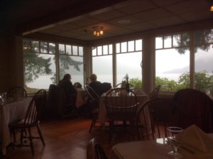
My friends and I had a lovely buffet Thanksgiving dinner there this year. The food and service were great, and we didn’t let a little bit of rain ruin our fun.

For information on the lodge or to obtain reservations, you can begin with https://www.nps.gov/olym/planyourvisit/visiting-lake-crescent.htm or http://www.olympicnationalparks.com or http://www.olympicnationalparks.com/lodging/dining/lake-crescent-lodge/

You can phone (360) 928-3211 for dinner reservations. The main floor of the lodge is handicapped accessible.

lake-crescent-on-thanksgiving-3

November 25, 2016 by dorothy Posted in blog 1 Reply

Sequim Treasures: The New Dungeness Lighthouse

November 9, 2016

By Dorothy Rice Bennett

Everybody loves lighthouses, right? I know I do. I’ve traveled the coast of Maine, up and down the California coastline, and followed Highway 101 through Oregon and Washington, always with the hope of finding another lighthouse. They are not only beautiful historic structures—they light up the coastline, and lighthouses suggest something positive, hopeful, and enlightened.

Not every coastal city or town has its own lighthouse. Sequim is one of the lucky ones. New Dungeness Lighthouse sits near the end of the Dungeness Spit north of the city proper. It is reachable by boat and by a rather long walk—more than five miles each way—along the Dungeness Spit from the Dungeness National Wildlife Refuge.

That particular spit of land was reputedly the first soil on which early sailors set foot as they explored what is today the Strait of Juan de Fuca and the Puget Sound. The lighthouse was opened in 1957; it stands sixty-three feet high and is still an active navigational aid.

Getting there

I’ve been fortunate to visit the New Dungeness Lighthouse by boat. Captain Charles Martin keeps a twenty-six-foot power catamaran, Livin’ the Dream, at the John Wayne Marina in Sequim and takes small groups of tourists on various water adventures. One available trip is to our lighthouse. My journey required passage through Sequim Bay to its mouth and then across Dungeness Bay toward the spit. There is no dock at the lighthouse, so our group transferred from the powerboat to a smaller inflatable that could go ashore to let us off and pick us up again. The lighthouse can also be reached by small power craft and kayaks from Cline Spit in Dungeness Bay.

Water travel to the lighthouse is admittedly very dependent on weather. Wind, high tides and waves can cause trip cancellations. Walking to the lighthouse can also be a challenge. At high tide, the spit is largely under water; therefore, the hike must be planned to start and finish within acceptable tide levels to avoid stepping on rocks and climbing over tree trunks. Starting times, resting periods at the lighthouse during low tide, and the return walk must be planned carefully.

Volunteer lighthouse keepers

Exploring this lighthouse is delightful fun. Outside, there are picnic tables, restrooms, green lawn, and a drinking fountain to help make hikers and boating visitors comfortable. Inside, there are tour guides available. They are called, quite logically, “Lighthouse Keepers.”

The keepers live in an adjoining building (modern inside with TV and WiFi) and spend a few hours daily maintaining the lighthouse and surrounding areas as well as providing tours. Keepers sign up to serve for a week and sometimes wait up to a year to get a slot. It’s not free—they pay for the privilege of staying at the lighthouse, but the cost for a week is about the same as a motel room would be. They cook for themselves, read, play table games, take hikes, watch TV, keep up with their Facebook pages—and enjoy the incredible serenity of the lighthouse grounds.

climbing-the-tower
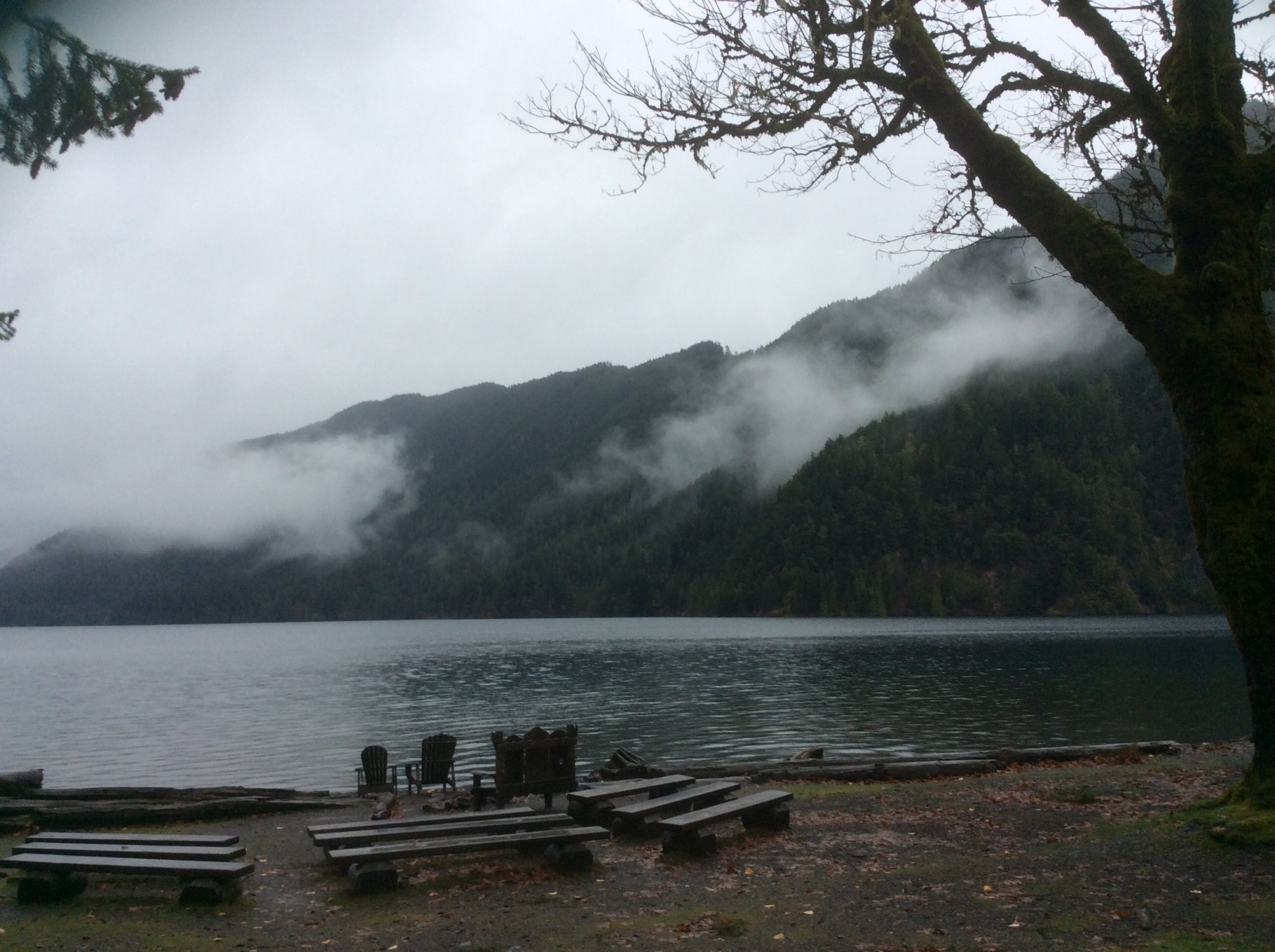
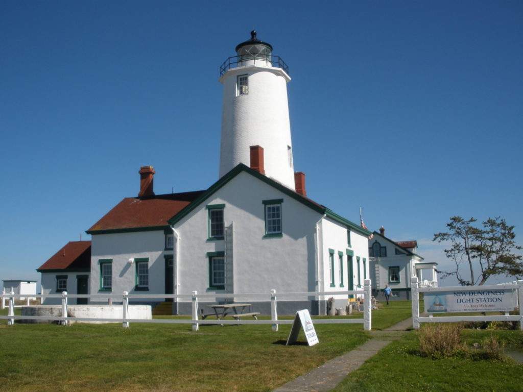
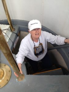
Tours of the museum and tower are available from 9 to 5 daily. Climbing the seventy-four steps to the top of the tower was a bit of a challenge for me but offered a marvelous view of the Dungeness Refuge, the Straits, and Canada. Outside, at ground level, I was impressed by the absence of noise. I cannot imagine a more peaceful setting!
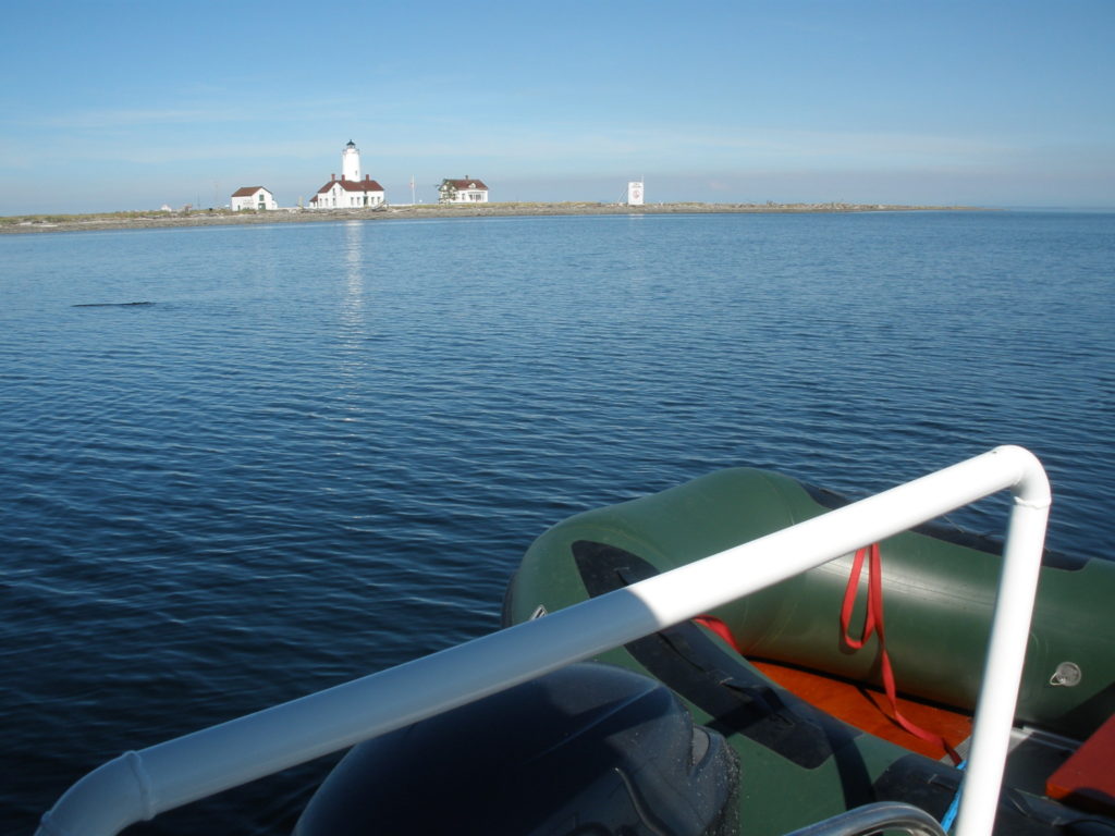
Two of the keepers during my visit were from Indianapolis in my home state of Indiana (I grew up in Speedway, home of the Indy 500) A married couple, the two had planned for a long time for their special week. Very friendly, they compared notes with me about the lighthouse and “back home in Indiana.” The Hoosiers raved about the wonderful air quality at the lighthouse and the quiet that they totally enjoyed.

The small museum on the bottom floor includes a Fresnel lamp, history of the lighthouse, displays about the Native Americans who have lived in this area, and of course, brochures about the lighthouse association. Very few souvenirs are available but can be purchased online (I got myself a lighthouse T-shirt, for example).

Back again

I loved being at the lighthouse so much that on a second visit by boat, I took with me friends that I knew would have a good time. While the weather can interfere, the climate on the Olympic Peninsula is relatively mild and the lighthouse provides a possible day-trip during most of the year.

If you are a real lighthouse aficionado, there are more day-trip lighthouses close to this area: Point Wilson Light at Fort Worden State Park near Port Townsend; Admiralty Head Lighthouse on Whidbey Island; Point No Point Light at Hansville near Kingston; and Cape Flattery Lighthouse on Tatoosh Island, visible from the far end of Cape Flattery Trail at Neah Bay on the Olympic Peninsula.

For current details about the New Dungeness Lighthouse, I suggest you go to the website http://newdungenesslighthouse.com  For information on boat tours to the lighthouse, check out http://thewaterlimousine.com

Happy lighthouse exploring!


November 9, 2016 by dorothy Posted in blog Reply

‘Moon Walking’ on Washington’s Pacific Coast

lunar-scape-of-white-at-rialto-beach

October 28, 2016

By Dorothy Rice Bennett

I wake up and it’s beautiful and sunny in Sequim. Seems like the perfect time for a day-trip somewhere. I check the weather on the Internet. Yes, it’s not only good here in the Blue Hole (as they say about Sequim) but all over the Olympic Peninsula. So, yes, it’s a good day to take off.

So many places we could go—Crescent Lake, Neah Bay, La Push, Hoh Rain Forest, Salt Creek Recreation Area, Rialto Beach. And others. What about Rialto Beach? Haven’t been there in a while. So Connie and I load up the car with a picnic basket, put the poodles in the back seat with their treats and leashes, gas up the car at the nearby QFC grocery, and we hit the 101 Highway headed west.

Picnic Time

An hour later we’ve passed through Port Angeles and have arrived at Lake Crescent. The 101 follows the southern edge of the lake for several miles, and we pull off near the Lake Crescent Lodge and take our picnic basket down by the waterside. At a picnic table, we sit and enjoy the view of this incredible lake while we have lunch and give treats to the dogs. And take a restroom break.

Back in the car, we pass the rest of Crescent Lake and head again west and then turn a bit south toward Forks, famous as the setting for the Twilight series of books and movies. Just before Forks, we turn right onto highway 110, which heads to La Push, home of the Quileute tribe of Native Americans. Here three rivers coming out of high Olympics merge and dump into the Pacific Ocean as the Quillayute River. Part of the way down the 110, there is a bridge across the river. You can stay on 110 and follow it into La Push, or if you cross to the north side of the river and follow Spur 110, you go to Rialto Beach.

There are many beaches along the Pacific in the state of Washington. Each has its own landscape and unique characteristics. Some of them are on Native American reservations; some are part of the Olympic National Park and Forest. Rialto Beach is officially located inside a coastal section of the national park.

Why Rialto Beach?

Rialto Beach faces the Pacific Ocean at an angle bringing strong winter storms and winds directly to the land. Like many beaches, there are numerous fallen tree trunks along the rock-strewn beach. But unlike many beaches, the trees have been bleached white. Even standing evergreen trunks along the landside of the beach are white. This extreme whiteness offers a touch of the ethereal to the human eye. When I first visited Rialto Beach, I said to my friends, “This looks like walking on the moon or a strange planet. It doesn’t look like Earth at all!”

Rialto Beach is blessed with several seastacks offshore as well as a rocky shoreline that provides numerous kinds and colors of polished rocks. At the south end of the beach, La Push is visible only a few hundred feet away, but separated by the mouth of the Quillayute River. It is an amazing fact of nature that one can be so close and yet not be able to reach that community. The parking area at Rialto Beach is reasonably large, with separate parking for RVs, and there are good public restrooms. If the weather is clement, there are also picnic tables available just back of the beach and within the first line of trees. Since this is the Pacific Ocean, it is wise to dress in layers.

Rialto Beach provides a visual feast. The hundreds of white tree trunks seem to go on forever. Great for climbing, great for photographs. I’ve included one here taken about three years ago, when my longtime friend Myrna Oliver came from Los Angeles to visit. Myrna is dressed in black; I am in red. Notice how white the tree trunk is behind us.

During my last visit, the weather changed from foggy to cloudy to partly sunny within a few moments of time. Our pictures changed in feel with each change in the weather.

From Sequim to Rialto Beach is a trip of about two hours each way, or about eighty-five miles each way. If you allow an hour at the beach to explore, you have a trip that can return you home by dinnertime. Or you can stop in Forks to eat before heading back—or in Port Angeles, on the way home.myrna-and-me-at-rialto-beach

October 28, 2016 by dorothy Posted in blog Reply

Olympic Wonders at the Ridge

mtncloudsOctober 12, 2016

By Dorothy Rice Bennett

One of the joys of living in the small community of Sequim, Washington, is that our town is like a hub with spokes extending in all directions. Each of these spokes leads to something beautiful, fun, educational, interesting, artistic, natural, amazing—or all of the above. And most of these destinations are close, accessible in a few moments or at least within a few hours.

Among the first places I was taken to visit when I came to Sequim was the Visitors’ Center at Hurricane Ridge in the Olympic National Park. Consider this: you leave Sequim, which sits at the southern end of a prairie barely a hundred feet above sea level, and in slightly more than an hour you move gradually uphill to nearly a mile above sea level. Amazing in itself!

Uphill climb

From Sequim, you take the 101 Highway to Port Angeles, which is seventeen miles to the west. At Race Street, you make a left turn, leaving the 101 behind, and gradually start your uphill climb. In a little more than a mile, you veer to the right on the park road leading to Hurricane Ridge. In five miles, you reach the visitors’ toll booth where you pay the fee, or show your senior card, which lets your entire carload in for free.

From the tollbooth you drive another twelve miles—winding among the mountains and valleys, amid stately evergreens and through tunnels, sometimes noticing mountain springs emerging from roadside rocks—until finally you break through to an open valley where the Hurricane Ridge Visitors’ Center is located. Just under a mile high.

Before you is laid out a big parking lot, and on nice days there are hundreds of parked cars all around. In the middle is a building that houses restrooms, viewing areas, a gift shop, a snack bar, and a movie viewing room. All of this on two levels. From the south side of the building, on both levels, you look at and take pictures of the majesty of the Olympic Mountains.

Wondrous views!

And majestic they are! Not the highest in the nation, with Mount Olympus topping out just under eight thousand feet, or the biggest—the Olympic range is compact, limited only to the Olympic Peninsula and totally inside the state of Washington—yet it is filled with numerous peaks, valleys, and glaciers. The total of the range is so intense, so wild, and so rugged that much of it unreachable to any except very experienced hikers and climbers. As a result, a national park is almost the only possible use of the land. So in 1938, the Olympic range was designated a national park and is now one of the most popular and most visited in the U.S.

The visitors’ center is open to the public throughout the summer months and also during the remainder of the year when weather permits. Winter snows can isolate Hurricane Ridge until the access road can be plowed, so the visitors’ center is kept open as much as possible on weekends and occasionally, when storm free, during some weekdays. It is wise in winter to check the status via the Internet before heading up the hill.

Spectacular all year round

The views from the center are spectacular. For active souls, during the winter it is possible to snowboard, cross country ski, and in a variety of ways enjoy the piled-high snow. During the summer months, there are numerous hiking and climbing trails available. The ridge offers virtually unlimited photo ops throughout the year. Deer are often present on the grasslands around the center. (Pets are allowed on leash in the parking area but not inside the visitors’ center building; there are restrictions on pets to be noted at various places inside the National Park.)

On the way up to Hurricane Ridge and back down to Port Angeles, there are several pull outs where you can visually survey the land, the cities, the Straits of Juan de Fuca, and even Canada on clear days.

I have been to Hurricane Ridge numerous times and in every season. The ridge never fails to excite and satisfy. I take all my houseguests there, and everyone raves about the beauty. And because it’s so close, we can leave after lunch and still be home by dinnertime—unless we decide to enjoy an evening meal at a restaurant in Port Angeles while we cruise through that neighboring community.

Have fun at Hurricane Ridge! You won’t be sorry that you made the drive!
mtnsnow

October 13, 2016 by dorothy Posted in blog Reply

Getting Cozy with the Animals

llama-with-bread-photo-for-top

September 28, 2016

By Dorothy Rice Bennett

We had a visitor a couple of weeks ago, and among the sights my cousin Jeanie wanted to see was the Olympic Game Farm. Having visited several times and liking the farm myself, I said, “Okay, let’s do it.”

The game farm is another one of Sequim’s “secrets.” Despite a few billboards and a preview trailer onscreen at the nearest movie theatre, the game farm is tucked away on the Sequim-Dungeness Prairie, beside a local road that runs toward the Straits and very near the Dungeness River. You’d never know it’s there—until you turn in the front gate.

Once a dairy farm, OGF is comprised of a few large pastures on fairly level ground, a small area of cages for animals that must be restricted, and a hilly area with a few displays—including deer and a prairie dog exhibit. You pay at the front gate and drive your car through the farm on a well-marked path. You also buy at the ticket booth loaves of bread to feed the animals. On a busy day, you may be winding your way behind a dozen cars ahead and with another large group behind you.

The afternoon that Jeanie and I went, the prairie dogs, peacocks, deer, and brown bears seemed to be having a siesta. Bread slices lay around untouched, and the bears hardly opened an eye as the cars passed. I was beginning to think our visit was a bust for Jeanie. Then we entered the first of the main pastures and began to encounter some hungry llamas. The idea is that you keep the car moving but you roll down your windows, and the animals come right up to your car and practically (sometimes actually) stick their heads inside looking for food. You have to be quick to give each one a bread slice, because they can be quite demanding and persistent, although “cute” at the same time.

Come and get it!

After we passed the llamas, we entered through cattle gates another bigger pasture that housed a few deer, several elk, and a large herd of buffalo. The elk and especially the buffalo seemed to be very hungry. We fed them as quickly as we could and moved on as soon as the car in front of us did so. I managed to snap a few pictures of the elk, but the buffalo were so persistent—even following the car—that I finally had to roll up my window in order to steer.

(After our encounter with the buffalo, I also had to wash my car on the way home, courtesy of Jeannie, because buffalo have big black tongues and lots of sticky saliva. But Jeanie was laughing at their antics, so it was worth it.)

There are a few caged animals at the farm, mostly ones that for some reason are not suited to being returned to the wild and are retained in accordance with Washington State regulations. The caging area is currently being upgraded and few animals are visible. There is one Siberian tiger, a fox or two, and some wolves identified on the fencing.

Once you leave the last pasture and exit the farm proper, you’ll find a gift shop and snack bar—ready for those who’ve been on the road and need restrooms and a bite to eat—and maybe a memento of their visit.

Dairy farmer works with Disney

The Olympic Game Farm is not a zoo in the usual sense. The originator, Lloyd Beebe, was a dairy farmer who took nature photographs as a hobby and then gradually built a relationship with filmmaker Walt Disney and served the Walt Disney Studios for some 28 years (Think Disney titles like Vanishing Prairie, White Wilderness, and Those Callaways). Beebe and his family trained animals for Disney films and even used the farm as a location for many pictures. After the death of Walt and Roy Disney, the studios moved away from nature filming, and as a result, the game farm was opened to the public in 1972. The facility is currently operated by Beebe’s grandsons, Robert and James Beebe.

OGF is open daily except for Thanksgiving and Christmas. During the summer, a combination tour is offered that includes several extra features, the most significant of which is the studio barn. Built in 1862, the barn was used in filming and today houses many relics from that period of operation. OGF’s fall hours, until Thanksgiving, are 9 a.m. to 4 p.m. For more information and ticket prices, visit the farm’s website, www.olygamefarm.com

See you at OGF, “home to the waving bears.” And stay tuned for more Sequim secrets!

lethargic-brown-bearphoto-for-bottom

October 1, 2016 by dorothy Posted in blog 1 Reply

Trestles and Trails

OLYMPUS DIGITAL CAMERA

September 12, 2016

By Dorothy Rice Bennett

Before I moved to Sequim, Washington, in 2010, I visited several times. One of the first places that friends took me—to experience the “secret” gems of Sequim—was the Railroad Bridge Park, which features a wooden bridge spanning the Dungeness River.

I was suitably impressed by the bridge and the river. “Dungeness,” I have learned, is a big word around here: Dungeness River, Dungeness Refuge, Dungeness Spit, New Dungeness Lighthouse, and Dungeness crab. In summer, the river under the bridge is a small stream bubbling over rocks and around curves and lined with tall trees. In the winter and spring, the Dungeness can roar under the bridge with a strong flow. Salmon swim upstream from the Straits of Juan de Fuca to spawn and can be seen performing their annual ritual in the moving waters below the bridge.

From railroad to hiking trail

While the bridge is beautiful, I didn’t understand its full significance until I learned a bit of local history. During the last century, trains ran across the Olympic Peninsula carrying a variety of products, including logs cut from the area forests. But as trucking via the 101 Highway took over the transportation of goods, railroads here were abandoned. And the unused railroad right of way gave birth to a new idea: the Olympic Discovery Trail—nearly 130 miles of paved hiking and biking trail from Port Townsend on the Admiralty Inlet of the Puget Sound to La Push on the Pacific Ocean. The trail hasn’t yet been completed, but there are large sections of it in daily use in and near Sequim and in Port Angeles and in some parts of the Olympic National Park. Paved in asphalt and eight feet wide, with periodic parking areas at posted “trailheads,” the Olympic Discovery Trail serves thousands of local residents and visitors as well.

Sequim has two landmark sections of the trail that are particular exciting to explore. One is—yes, you guessed it—the Railroad Bridge over the Dungeness River. The second is a long, curving trestle over the smaller Johnson Creek, which runs downhill through the John Wayne Marina and empties into Sequim Bay.

Both of these landmarks are part of what I call Sequim’s “secrets,” because neither is particularly visible. To reach the railroad bridge, you follow signs from Sequim’s Washington Street back into a forested area by the river and wind around curves until suddenly the bridge is in front of you. (Another entrance from the west end of the park also involves a considerable hike before you can see the bridge.) The Johnson Creek Trestle stands only a few feet from Highway 101 but is hidden in a grove of old forest growth and therefore invisible from the highway or from Whitefeather Way, which runs from the 101 downhill to the John Wayne Marina at water’s edge of Sequim Bay.

Bridge and trestle

The railroad bridge was built in 1915 by The Milwaukee Road and today is considered the “heart” of the Olympic Discovery Trail. Unfortunately, a violent winter storm in February 2015 almost brought the magic of this bridge to an end. Although the bridge structure was spared, the walkway approaching from the west was severely damaged, along with much of the old forest growth by the Dungeness at that point. The Jamestown S’Klallam Tribe, which owns the land on which the park is built, was able to borrow funds, and after several months, the bridge trestle was reopened to the public. During the rebuilding phase, the Railroad Bridge Park celebrated its 100th birthday.

The Johnson Creek Trestle, 410 feet long, is the longest trestle on the Olympic Peninsula, and from the top, visitors look down 86 feet toward the trestle’s support beams and the creek below. Built in 1914, the trestle saw its last train in 1983. Repurposed by a group of volunteers for use by the Olympic Discovery Trail, it is today well maintained. With a beautiful curving line, the trestle is one of Sequim’s amazing “secrets.”

Both the railroad bridge and the Johnson Creek trestle are wonderful to visit and explore. Both are surrounded by forest growth. From both you can feel the stillness of nature and listen to the soothing flow of water beneath. Both are healing to the spirit and worth many a repeat visit.

See you there, sometime soon.

johnson-creek-trestle

September 14, 2016 by dorothy Posted in blog Reply

Sequim: The Blue Hole!

BlueSkyBlueHole

By Dorothy Rice Bennett

When we talk about Sequim, Washington, we have to start with the city’s unusual name. People living elsewhere tend to pronounce it Se-quim, in two syllables, like sequins. But the “e” is silent, making it more like squish or squirrel. Where did the name come from? There are theories, but nobody seems to know for sure.

Sequim is a small community on the North Olympic Peninsula, along Highway 101 with the Olympic Mountains to the south and a prairie and the Straits of Juan de Fuca to the north. Port Townsend sits to the east, and Port Angeles is a few miles to the west.

The flat land, known as the Sequim-Dungeness Prairie, was settled before the town developed. Hence Sequim’s annual Irrigation Festival is nearly twenty years older Sequim, which celebrated its centennial in 2013. The town itself has slightly more than six thousand residents, but the total population of the valley is closer to thirty thousand.

Not a flashy town

Although a thriving community, Sequim is not particularly flashy. Drive down its main street, and you’ll see restaurants, shops, and big box stores—but although it has been highly ranked as a Pacific Coastal Community and as a “best” place to retire, at first glance it’s just a small town.

People visit Sequim for many reasons—to see friends and relatives, to shop at big box stores, to get gas and a bite to eat on the way to the mountains or the ocean, or to attend one of Sequim’s annual festivals, the Irrigration Festival in May or the Lavender Festival in July. Maybe to put a boat in the water at the John Wayne Marina. (Yes, that is THE John Wayne. The Hollywood icon once owned a big boat that he kept here, and his family still owns the property he bought.) Fishermen come to the marina with their trailered boats to participate in open fishing seasons for world-famous Dungeness crab, halibut, and salmon.

Sequim’s real attractions are more subtle. There are secrets here, secrets that take time to find and explore. And beautiful treasures that bring people back again and again until they move here. One of Sequim’s treasures is the “blue hole.”

The town and its prairie sit in what is known as a “rainshadow.” Storms from the Pacific Ocean are parted by the Olympic mountain range, and rainfall largely skips over the Sequim-Dungeness Prairie and lands to the east and the west and then in Seattle across the Puget Sound. In a region known for heavy rainfall, Sequim receives less than twenty inches annually. The prairie was actually desert until pioneers introduced irrigation, using water from the Dungeness River and other waterways emerging from the mountains. At one time nearly one-hundred dairies thrived here. Today most of the farmland has been turned into residential and small business properties.

Because of this unique position just north of the Olympics, Sequim enjoys active skies that are forever changing. Sun one moment, white puffy clouds the next, morning coastal fog, some days with gray skies, and yes, sometimes a rainy day—although seldom really drenching rain. More often showers or drizzle. Wearing a raincoat or carrying an umbrella is not all that common among the locals.

Pilots see the hole

It is almost as if the clouds part over Sequim. Hence the name “the blue hole.” Airline pilots landing at SeaTac International Airport have reported one open spot in otherwise overcast skies. That one open spot is more often than not directly over Sequim. From the ground, you can be driving toward Sequim in rain or clouds and reach Sequim in sunshine. While not guaranteed to work that way, it happens often enough to give Sequim the blue hole reputation.

Thanks in part to this climate quirk, one of Sequim’s biggest attractions for visitors and retirees is its weather. Four seasons with mild summer and winter—compared to most of the rest of the US. A touch of snow maybe once a season. A few days in the 80s in the summer. A colorful fall and a flowering spring. A great climate for growing things. Clean air to breathe. A wonderful place to walk, hike, sit in the sun, think, create, and explore the wonders of nature.

I arrived in 2010—having grown up near Indianapolis and having lived in California’s Bay Area, New Orleans, Phoenix, and San Diego—and I found Sequim to my liking and have decided to stay. And, yes, the “blue hole” is real.
SunsetInNeighborhood

August 27, 2016 by dorothy Posted in blog Reply

Dorothy’s Blog!

Alice at Hurricane Ridge

By Dorothy Rice Bennett

[This is the first in a series of blogs that will mostly deal with living on the Olympic Peninsula in Washington State. However, I need to introduce myself first. I am 74, a lesbian, a retired journalist and psychotherapist, an adoptive mother and grandmother, and I live with my partner and two toy poodles in Sequim. I have wanted to write all my life, but something always seemed to get in the way—until I retired and could focus on my creative urges at last. I have published two novels and hope to complete at least two more in the next few years.]

Why GIRLS ON THE RUN?

Writing inevitably emerges from the heart and soul of a writer, no matter how much he/she may try to distance him/herself from the content of the material. Whether the writing is openly autobiographical at one extreme or as far removed from the real world as a fantasy tale at the other, the creative spark is somehow tied to the writer’s experiences, inner feelings, or belief system.

Using myself as an example, I’ll share that my new novel, GIRLS ON THE RUN, which is on the surface totally fictional and deals with new beginnings in life and love, was started in 2011 during a major crisis in my personal life.

The year before, 2010, when the nation’s economy was in the tank, I moved with my partner, Vera Foster, to the small community of Sequim, Washington, on the Olympic Peninsula. Five months after our arrival, while we were still acclimating ourselves to this environment so radically different from our previous home in San Diego, Vera suffered a heart attack while sitting across from me in our living room.

In an instant she was gone, and in an unfamiliar world I had to begin my life all over again. Besides working through the sorrow of my loss, I had emergency abdominal surgery and two age-related eye surgeries in the first few months after Vera’s passing. It was not an easy time.

I needed something positive to give me a lift, so I got a puppy to bring smiles to my world and turned to my long-time love of writing. I began to think of starting a new novel. An idea came to me, of two young women, who were both thrust by pivotal moments of change into creating new lives. I could have written about one woman, but that would too lonely for me, especially at that moment. So I created two heroines and then let them do their own thing in my head.

While the title may suggest a thriller, GIRLS ON THE RUN is more about running psychologically, then healing and finding both a place in the world and a partner to love. Jennifer goes on the run because of a situation in Pittsburgh that threatens physical harm—the threat gets her out the door and onto the highway. Stacy has a fight with her family over her sexuality, and her anger at their lack of acceptance of her lesbianism drives her out the front door and onto the road as well. Their paths cross, and they reach out to each other for support. They begin talking to each other, they form a friendship, and the story evolves from there.

Universal themes

A love story is my natural environment. As an only child, I experienced little outward expression of love and affection during my youth, and I moved into adulthood with a major “unmet need” for love and affection.  Hence I write about characters who are looking for love. Without love, our world would be a sorry place—if it continued to exist at all. So love is an important topic, not only for me. Love is universal.

My second theme is friendship. Humans don’t live in a vacuum, and friendship—as well as family—is a very significant part of life. In NORTH COAST: A Contemporary Love Story, I focused on friendship among several lesbian women in Eureka, California. The way the friends help and support one another is one of the strong points of that book.

In GIRLS ON THE RUN, I focus on families and the need for healing in families—and on the ways that co-workers and employers can become significant others in our lives. I have created a supporting cast that helps contribute to key scenes in the story. I like these characters, who are as realistic as I can make them, and I think that my readers will like them too.

GIRLS ON THE RUN was just released a month ago and is just beginning its publishing journey. We’ll see where we go from here. There are, of course, other books in my computer, as well as in my head, and my challenge is to bring them to fruition as quickly as I can. After all, I’m 74, and I don’t have forever to make my mark as an author!

Dorothy Rice Bennett

August 16, 2016 by dorothy Posted in blog Reply

EVENTS


FREE SHORT STORY!
Sign up for my newsletter mailing list, and I'll send you a free copy of a steamy short story I wrote called "High Rollers." (Put Free Short Story in the subject line.)

LONG-DISTANCE LOVING
Dorothy Rice Bennett’s sixth lesbian romance novel is a sequel to her last book, LIVES INTERTWINED: Love on Sequim Bay (2020), set in Sequim, Washington, on the beautiful Olympic Peninsula. Available now at AMAZON


DRB Novels on SALE!
iheartsapphfic.com sponsors lesbian fiction sales every Monday through Friday. Sales are announced each Friday on this site and on twitter and facebook.
Dorothy Rice Bennett novels are included in these Kindle sales, during which the books are offered not only in the US but through worldwide Amazon markets for $.99 (or the equivalent in a foreign country). 

&copy 2016 Dorothy Rice Bennett |
↑

Sign Up for My Newsletter